ZCZC MIATWOAT ALL
TTAA00 KNHC DDHHMM
Tropical Weather Outlook
NWS National Hurricane Center Miami FL
100 AM EST Tue Nov 13 2018
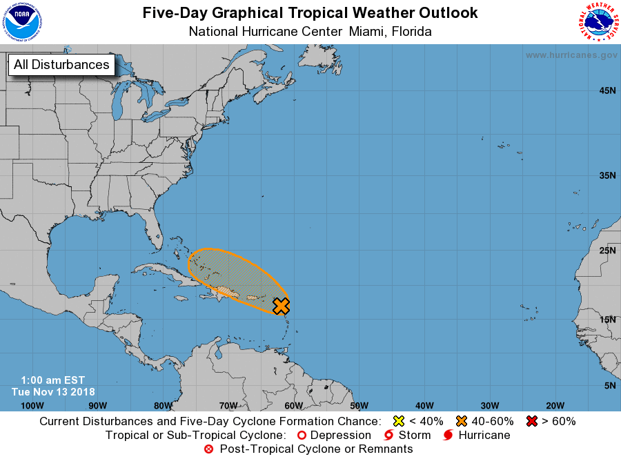
For the North Atlantic...Caribbean Sea and the Gulf of Mexico:
1. Shower and thunderstorm activity associated with a tropical wave
that is moving through the Leeward Islands has continued to become
less organized tonight. Environmental conditions are not expected
to become significantly better for development, and the system is
also expected to interact with the islands of the Greater Antilles
during the next few days. Therefore, the potential for this
system to become a tropical or subtropical cyclone continues to
decrease. Regardless of development, this system is forecast to
bring locally heavy rainfall to portions of the Leeward Islands, the
Virgin Islands, and Puerto Rico over the next few days.
* Formation chance through 48 hours...low...30 percent.
* Formation chance through 5 days...medium...40 percent.
Forecaster Brown