ZCZC MIATWOAT ALL
TTAA00 KNHC DDHHMM
Tropical Weather Outlook
NWS National Hurricane Center Miami FL
100 PM EST Sun Nov 11 2018
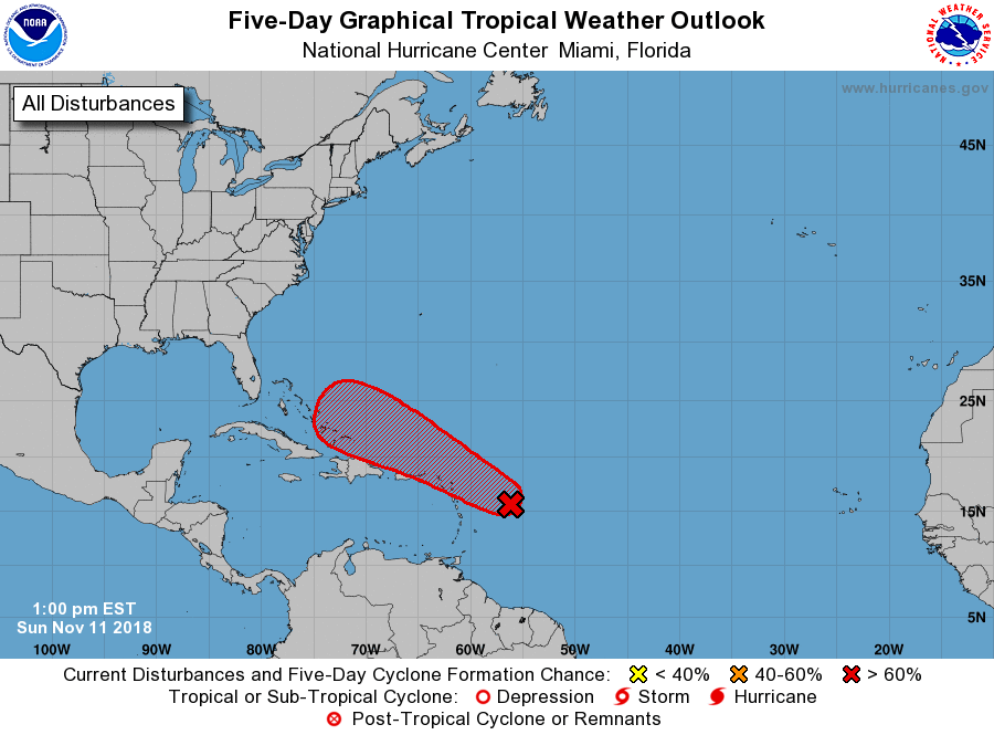
For the North Atlantic...Caribbean Sea and the Gulf of Mexico:
1. Showers activity has increased and become a little better organized
today in association with a tropical wave located about 350 miles
east-southeast of the Leeward Islands. Environmental conditions are
forecast to gradually become more conducive for development by
Tuesday, and a tropical or subtropical cyclone is expected to form
by the middle of the week. The system will move westward to
west-northwestward for the next few days, passing near or north of
the Leeward Islands, Puerto Rico, Hispaniola, and the southeastern
Bahamas.
* Formation chance through 48 hours...low...20 percent.
* Formation chance through 5 days...high...70 percent.
Forecaster Stewart