ZCZC MIATWOAT ALL
TTAA00 KNHC DDHHMM
Tropical Weather Outlook
NWS National Hurricane Center Miami FL
200 PM EDT Mon Oct 15 2018
For the North Atlantic...Caribbean Sea and the Gulf of Mexico:
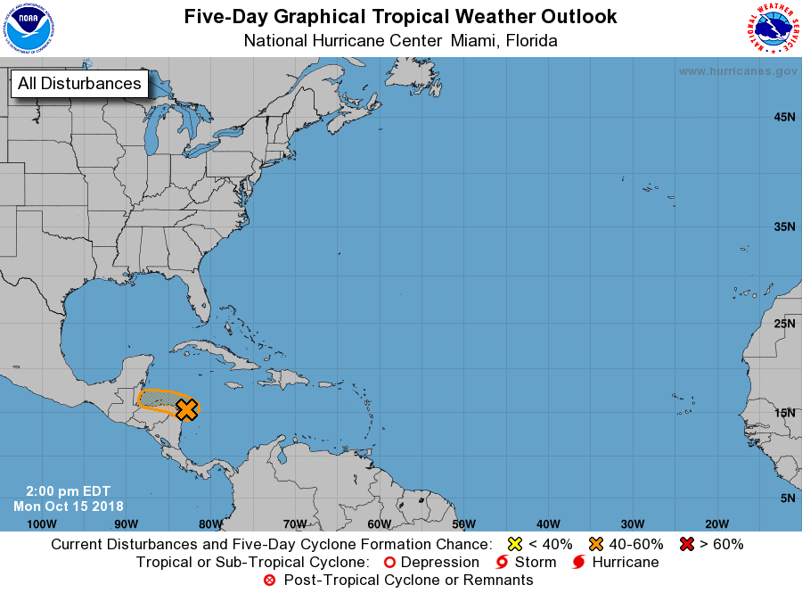
1. Showers and thunderstorms associated with a broad area of low
pressure located just offshore of northeastern Honduras contine to
show some signs of organization. The system is expected to move near
or just offshore of north coast of Honduras, and it is possible that
it could become a tropical depression before the low moves inland
over Belize late Tuesday. Regardless of development, locally heavy
rainfall, which could cause flash flooding, is possible across
portions of Central America for much of the week. An Air Force
Reserve Hurricane Hunter aircraft is scheduled to investigate this
system on Tuesday afternoon.
* Formation chance through 48 hours...medium...40 percent.
* Formation chance through 5 days...medium...40 percent.
Forecaster Blake