ZCZC MIATWOAT ALL
TTAA00 KNHC DDHHMM
Tropical Weather Outlook
NWS National Hurricane Center Miami FL
200 AM EDT Tue Oct 9 2018
For the North Atlantic...Caribbean Sea and the Gulf of Mexico:
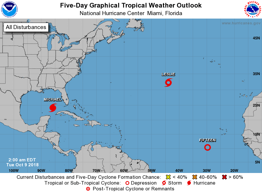
The National Hurricane Center is issuing advisories on Hurricane
Michael, located over the southern Gulf of Mexico, and on Tropical
Storm Leslie, located over the central Atlantic Ocean.
1. Showers and thunderstorms continue to become better organized in
association with a low pressure system located about 500 miles
southwest of the Cabo Verde Islands. However, satellite wind data
indicate that the circulation of the system is still elongated.
Environmental conditions are expected to be conducive for
development, and a tropical depression is likely to form later
today or on Wednesday while the system moves west-northwestward or
northwestward. By late this week, strong upper-level winds are
expected to limit further development.
* Formation chance through 48 hours...high...80 percent.
* Formation chance through 5 days...high...90 percent.
Forecaster Cangialosi