ZCZC MIATWOAT ALL
TTAA00 KNHC DDHHMM
Tropical Weather Outlook
NWS National Hurricane Center Miami FL
200 PM EDT Mon Oct 8 2018
For the North Atlantic...Caribbean Sea and the Gulf of Mexico:
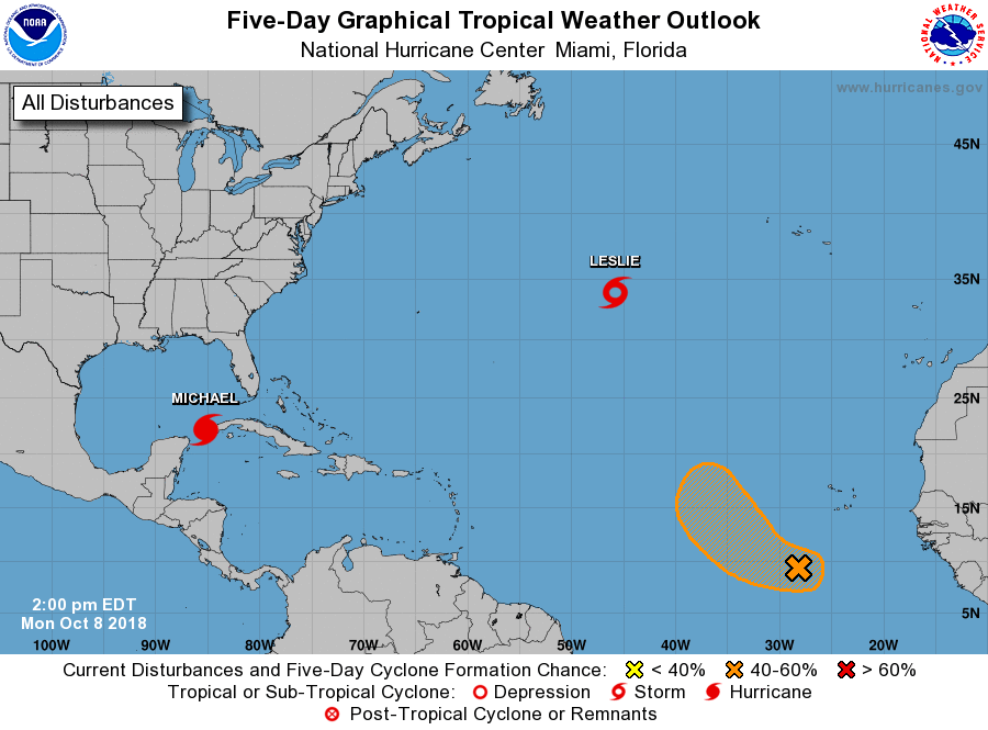
The National Hurricane Center is issuing advisories on Hurricane
Michael, located near the western tip of Cuba, and on Tropical Storm
Leslie, located over the central Atlantic Ocean.
1. Showers and thunderstorms associated with a tropical wave located
several hundred miles southwest of the Cabo Verde Islands continue
to show signs of organization. However, recent satellite data
indicate that the system currently lacks a well-defined surface
circulation. Environmental conditions are expected to be conducive
for development during the next few days, and a tropical depression
could form while the system moves generally west-northwestward. By
late this week, strong upper-level winds are expected to limit
further development of the disturbance.
* Formation chance through 48 hours...medium...50 percent.
* Formation chance through 5 days...medium...60 percent.
Forecaster Zelinsky