ZCZC MIATWOAT ALL
TTAA00 KNHC DDHHMM
Tropical Weather Outlook
NWS National Hurricane Center Miami FL
800 AM EDT Thu Sep 27 2018
For the North Atlantic...Caribbean Sea and the Gulf of Mexico:
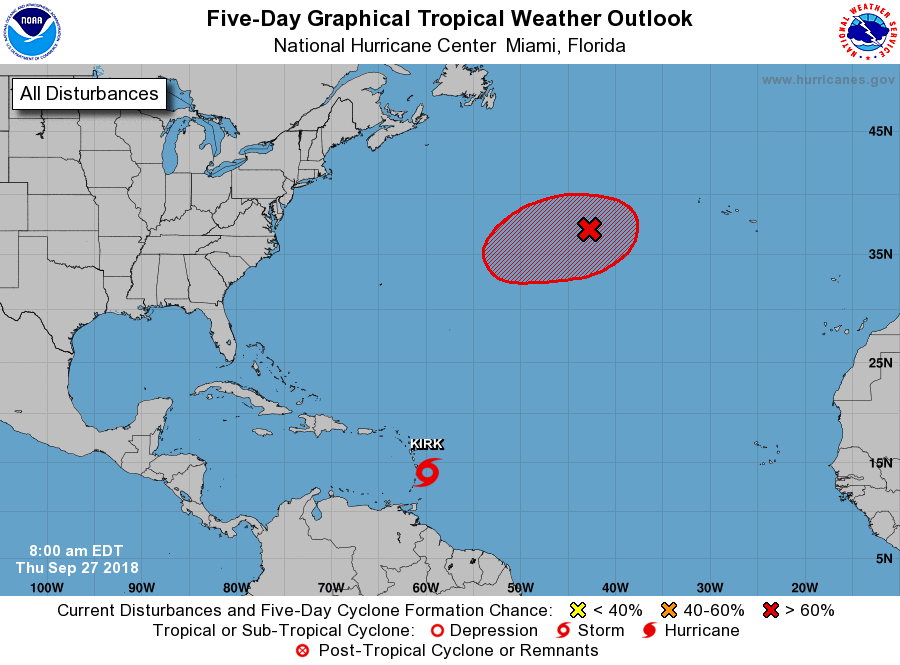
The National Hurricane Center is issuing advisories on Tropical
Storm Kirk, located a couple of hundred miles east of the Lesser
Antilles.
1. Post-Tropical Cyclone Leslie, located over the central Atlantic
Ocean several hundred miles west of the Azores, remains a powerful
non-tropical low with hurricane-force winds. The associated shower
activity is gradually becoming more organized, and Leslie is
expected to again become a subtropical storm, or possibly a tropical
storm, later today or Friday while it moves west-southwestward at
about 10 mph over the north-central Atlantic. For more information
on this system, see High Seas Forecasts issued by the National
Weather Service.
* Formation chance through 48 hours...high...90 percent.
* Formation chance through 5 days...high...90 percent.
High Seas Forecasts issued by the National Weather Service can be
found under AWIPS header NFDHSFAT1, WMO header FZNT01 KWBC, and
on the Web at https://ocean.weather.gov/shtml/NFDHSFAT1.shtml.
Forecaster Beven