ZCZC MIATWOAT ALL
TTAA00 KNHC DDHHMM
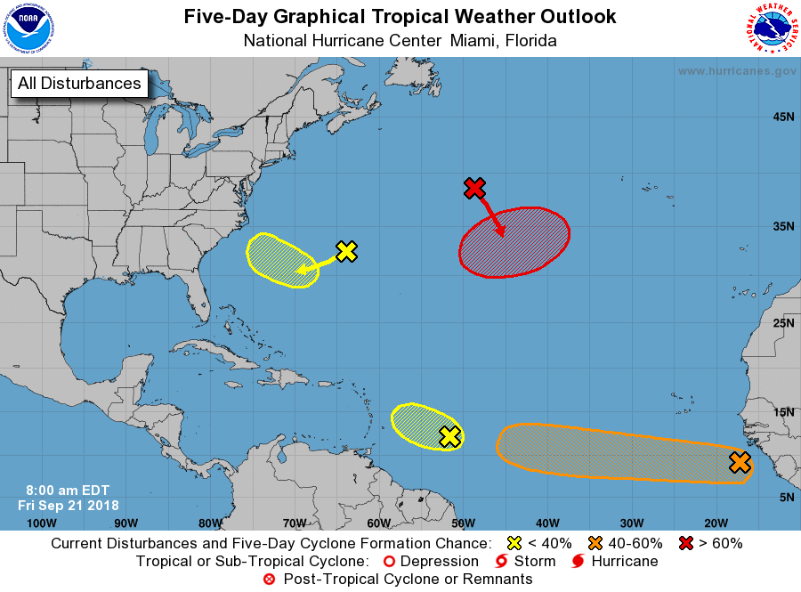
Tropical Weather Outlook
NWS National Hurricane Center Miami FL
Issued by the NWS Weather Prediction Center College Park MD
800 AM EDT Fri Sep 21 2018
For the North Atlantic...Caribbean Sea and the Gulf of Mexico:
1. Showers and thunderstorms associated with a tropical wave located
about 600 miles southeast of the Cabo Verde Islands are showing some
signs of organization. The environment is forecast to be conducive
for slow development, and a tropical depression could form early
next week while the system moves westward at 15 to 20 mph across the
low latitudes of the eastern and central tropical Atlantic Ocean.
* Formation chance through 48 hours...low...20 percent.
* Formation chance through 5 days...medium...60 percent.
2. A weak low pressure area located about 600 miles east of the
Windward Islands is producing disorganized showers and
thunderstorms. The combination of dry mid-level air and strong
upper-level winds is expected to hinder any further development of
this low while it moves west-northwestward at around 10 mph.
* Formation chance through 48 hours...low...10 percent.
* Formation chance through 5 days...low...10 percent.
3. A broad area of low pressure located just southeast of Bermuda is
producing minimal shower activity while it moves southward at 10 to
15 mph. Although a combination of dry air and strong upper-level
winds is expected to inhibit any significant development over the
next few days, the environment could become conducive for slow
development when the system moves over the southwest Atlantic Ocean
during the middle part of next week.
* Formation chance through 48 hours...low...near 0 percent.
* Formation chance through 5 days...low...20 percent.
4. A non-tropical low pressure system is forecast to develop tonight
over the central subtropical Atlantic Ocean midway between Bermuda
and the Azores. Conditions are expected to be conducive for the low
to acquire subtropical or tropical characteristics, and a
subtropical or tropical cyclone is expected to form late this
weekend or early next week while the low meanders over the central
Atlantic Ocean.
* Formation chance through 48 hours...low...10 percent.
* Formation chance through 5 days...high...70 percent.
Forecaster Campbell/Blake