ZCZC MIATWOAT ALL
TTAA00 KNHC DDHHMM
Tropical Weather Outlook
NWS National Hurricane Center Miami FL
800 PM EDT Wed Sep 19 2018
For the North Atlantic...Caribbean Sea and the Gulf of Mexico:
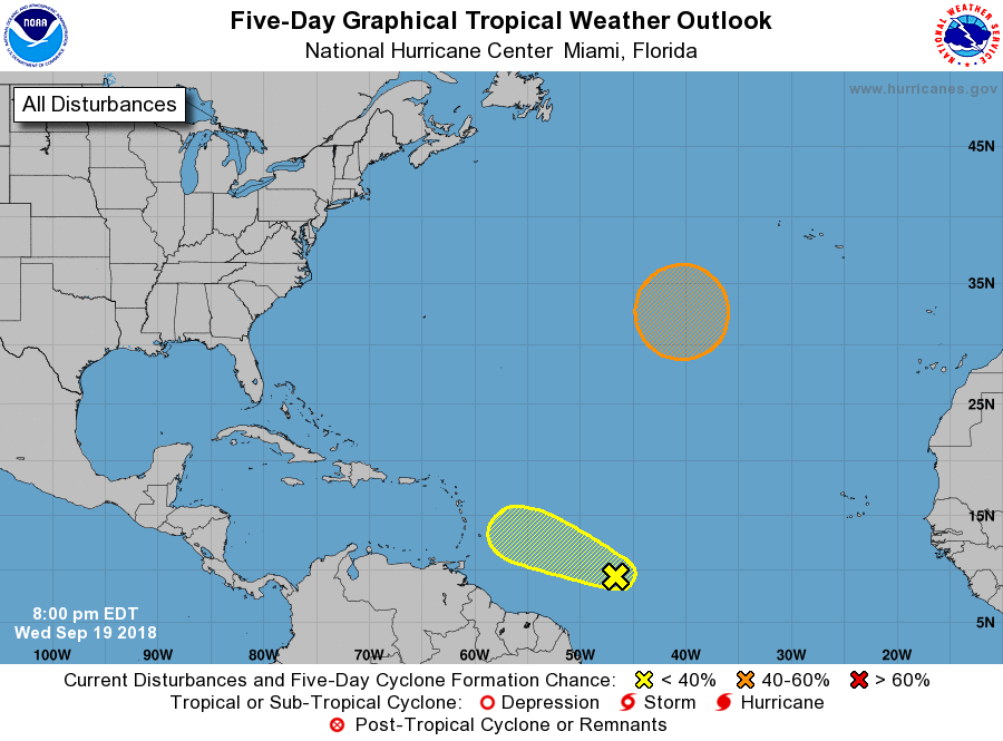
1. A westward-moving tropical wave is producing a small but
concentrated area of thunderstorms about 900 miles east of the
Windward Islands. Some slow development of this disturbance will be
possible through early Friday before environmental conditions become
quite unfavorable for tropical cyclone formation by late Friday and
continuing through the weekend.
* Formation chance through 48 hours...low...20 percent.
* Formation chance through 5 days...low...20 percent.
2. A non-tropical low pressure system is forecast to develop this
weekend over the central subtropical Atlantic Ocean between Bermuda
and the Azores. After that time, conditions are expected to become
favorable for the formation of a subtropical or tropical cyclone
while the low meanders over the central Atlantic.
* Formation chance through 48 hours...low...near 0 percent.
* Formation chance through 5 days...medium...40 percent.
Forecaster Stewart