ZCZC MIATWOAT ALL
TTAA00 KNHC DDHHMM
Tropical Weather Outlook
NWS National Hurricane Center Miami FL
800 AM EDT Wed Sep 19 2018
For the North Atlantic...Caribbean Sea and the Gulf of Mexico:
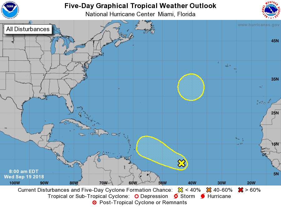
1. A large area of disturbed weather located a little more than 1000
miles east of the Windward Islands is associated with a tropical
wave moving westward about 10 to 15 mph. Some slight development is
possible during the next day or two before the environment becomes
unfavorable for tropical cyclone formation.
* Formation chance through 48 hours...low...20 percent.
* Formation chance through 5 days...low...20 percent.
2. A non-tropical low is forecast to form this weekend between Bermuda
and the Azores. After that time, conditions are expected to be
favorable for subtropical or tropical cyclone formation while the
low meanders over the north Atlantic.
* Formation chance through 48 hours...low...near 0 percent.
* Formation chance through 5 days...low...20 percent.
Forecaster Avila