ZCZC MIATWOAT ALL
TTAA00 KNHC DDHHMM
Tropical Weather Outlook
NWS National Hurricane Center Miami FL
800 AM EDT Tue Sep 4 2018
For the North Atlantic...Caribbean Sea and the Gulf of Mexico:
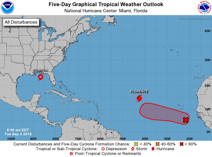
The National Hurricane Center is issuing advisories on Tropical
Storm Florence, located over the eastern Atlantic Ocean, and
on Tropical Storm Gordon, located less than 200 miles southeast
of the Mouth of the Mississippi River.
1. A tropical wave accompanied by a broad low pressure system located
a few hundred miles south-southeast of the Cabo Verde Islands is
forecast to move slowly westward to west-northwestward across the
eastern tropical Atlantic for the next several days. Although this
disturbance continues to produce disorganized showers and
thunderstorms, environmental conditions are expected to gradually
become conducive for further development, and a tropical depression
is likely to form by late this week or this weekend.
* Formation chance through 48 hours...low...20 percent.
* Formation chance through 5 days...high...70 percent.
Forecaster Stewart