ZCZC MIATWOAT ALL
TTAA00 KNHC DDHHMM
Tropical Weather Outlook
NWS National Hurricane Center Miami FL
200 PM EDT Mon Sep 3 2018
For the North Atlantic...Caribbean Sea and the Gulf of Mexico:
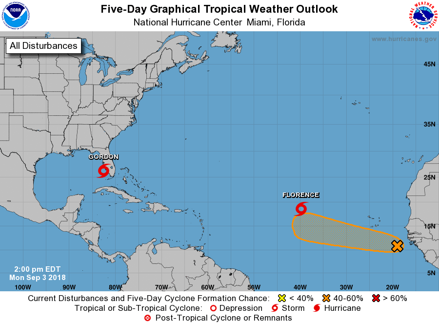
The National Hurricane Center is issuing advisories on Tropical
Storm Florence, located over the eastern Atlantic Ocean and on newly
formed Tropical Storm Gordon, located near the southwest coast of
Florida.
1. A tropical wave located more than 400 miles southeast of the Cabo
Verde Islands is producing a large area of disorganized showers and
thunderstorms. Some slow development of this disturbance is
possible during the next several days while the system moves
westward to west-northwestward across the eastern tropical Atlantic.
* Formation chance through 48 hours...low...10 percent.
* Formation chance through 5 days...medium...40 percent.
Public Advisories on Gordon are issued under WMO header WTNT32 KNHC
and under AWIPS header MIATCPAT2. Forecast/Advisories on Gordon are
issued under WMO header WTNT22 KNHC and under AWIPS header
MIATCMAT2.
Forecaster Stewart