ZCZC MIATWOAT ALL
TTAA00 KNHC DDHHMM
Tropical Weather Outlook
NWS National Hurricane Center Miami FL
200 AM EDT Fri Aug 17 2018
For the North Atlantic...Caribbean Sea and the Gulf of Mexico:
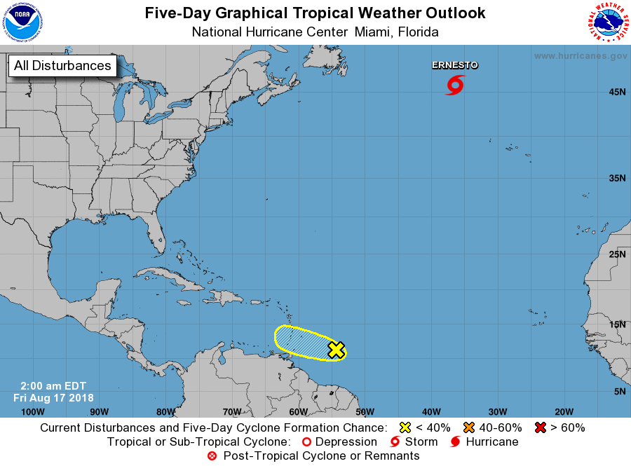
The National Hurricane Center is issuing advisories on Tropical
Storm Ernesto, located several hundred miles east of Cape Race,
Newfoundland.
1. A tropical wave located about 500 miles east-southeast of the
Windward Island continues to produce a large area of disorganized
showers and thunderstorms. Development, if any, of this system
should be slow to occur during the next day or two while it moves
west-northwestward around 15 mph toward the Windward Islands. By
late Saturday, unfavorable environmental conditions should limit the
chances for additional development while the system moves over the
eastern Caribbean Sea. Regardless of development, this system is
likely to bring locally heavy rainfall to portions of the Lesser
Antilles later today and this weekend.
* Formation chance through 48 hours...low...20 percent.
* Formation chance through 5 days...low...20 percent.
Forecaster Cangialosi