ZCZC MIATWOAT ALL
TTAA00 KNHC DDHHMM
Tropical Weather Outlook
NWS National Hurricane Center Miami FL
200 AM EDT Thu Aug 16 2018
For the North Atlantic...Caribbean Sea and the Gulf of Mexico:
The National Hurricane Center is issuing advisories on Subtropical
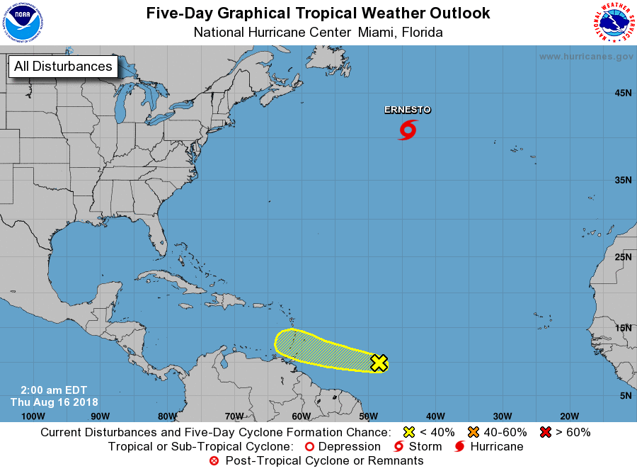
Storm Ernesto located several hundred miles southeast of Cape Race,
Newfoundland.
1. Disorganized showers and thunderstorms located about 750 miles
east-southeast of the Windward Islands are associated with a
tropical wave. Gradual development of this system is
possible over the next 2 to 3 days while it moves
west-northwestward at 15 to 20 mph toward the Windward Islands.
After that time, unfavorable environmental conditions should limit
the chances for additional development when the system moves over
the eastern Caribbean Sea.
* Formation chance through 48 hours...low...10 percent.
* Formation chance through 5 days...low...20 percent.
Public Advisories on Subtropical Storm Ernesto are issued under
WMO header WTNT35 KNHC and under AWIPS header MIATCPAT5.
Forecast/Advisories on Subtropical Storm Ernesto are issued under
WMO header WTNT25 KNHC and under AWIPS header MIATCMAT5.
Forecaster Cangialosi