ZCZC MIATWOAT ALL
TTAA00 KNHC DDHHMM
Tropical Weather Outlook
NWS National Hurricane Center Miami FL
800 PM EDT Wed Aug 15 2018
For the North Atlantic...Caribbean Sea and the Gulf of Mexico:
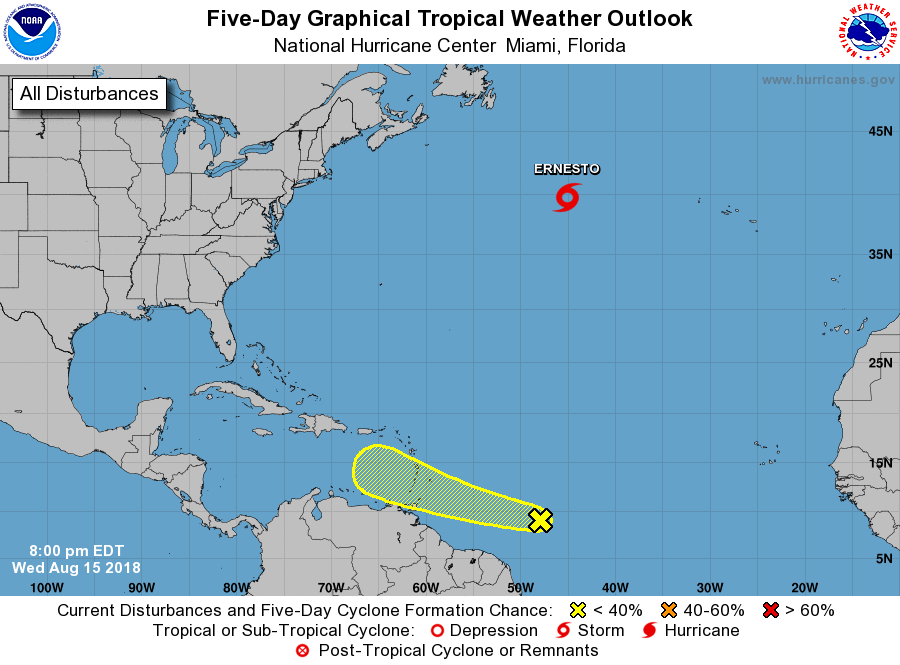
The National Hurricane Center is issuing advisories Subtropical
Storm Ernesto located several hundred miles southeast of Cape Race,
Newfoundland.
1. A tropical wave located about 850 miles east-southeast of the
Windward Islands is producing a large area of cloudiness and
thunderstorms. Slow development of this disturbance is possible over
the next few days while the system moves west-northwestward at 15 to
20 mph. By early next week, however, upper-level winds are expected
to become less conducive for any significant development to occur
when the system will be moving over the eastern Caribbean Sea.
* Formation chance through 48 hours...low...10 percent.
* Formation chance through 5 days...low...20 percent.
Public Advisories on Subtropical Storm Ernesto are issued under
WMO header WTNT35 KNHC and under AWIPS header MIATCPAT5.
Forecast/Advisories on Subtropical Storm Ernesto are issued under
WMO header WTNT25 KNHC and under AWIPS header MIATCMAT5.
Forecaster Stewart