Skip Navigation Links
NOAA NOAA United States Department of Commerce

NHC Graphical Outlook Archive


« Earliest Available         ‹ Earlier         Later ›         Latest Available »
GIS Shapefiles
tab Eastern North Pacific tab tab Atlantic tab

View 2-Day Graphical Tropical Weather Outlook
Click for Eastern North Pacific Click for Eastern North Pacific

Tropical Weather Outlook Text

ZCZC MIATWOAT ALL
TTAA00 KNHC DDHHMM

Tropical Weather Outlook
NWS National Hurricane Center Miami FL
200 PM EDT Tue Aug 14 2018

For the North Atlantic...Caribbean Sea and the Gulf of Mexico:

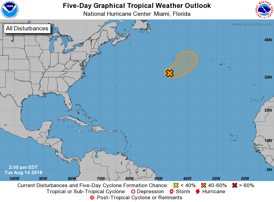
1. A non-tropical low appears to be forming to the east of the larger
complex low pressure system centered several hundred miles south of
Cape Race, Newfoundland.  This new low could acquire some
subtropical characteristics by Wednesday.  However, after that time
the low should be moving northeastward over colder waters and be
absorbed by a larger extratropical cyclone.
* Formation chance through 48 hours...medium...40 percent.
* Formation chance through 5 days...medium...40 percent.

Forecaster Avila


List of Atlantic Outlooks (May 2023 - present)
List of East Pacific Outlooks (May 2023 - present)
List of Central Pacific Outlooks (May 2023 - present)
List of Atlantic Outlooks (July 2014 - April 2023)
List of East Pacific Outlooks (July 2014 - April 2023)
List of Central Pacific Outlooks (June 2019 - April 2023)
List of Atlantic Outlooks (June 2009 - June 2014)
List of East Pacific Outlooks (June 2009 - June 2014)