Skip Navigation Links
NOAA NOAA United States Department of Commerce

NHC Graphical Outlook Archive


« Earliest Available         ‹ Earlier         Later ›         Latest Available »
GIS Shapefiles
tab Eastern North Pacific tab tab Atlantic tab

View 2-Day Graphical Tropical Weather Outlook
Click for Eastern North Pacific Click for Eastern North Pacific

Tropical Weather Outlook Text

ZCZC MIATWOAT ALL
TTAA00 KNHC DDHHMM

Tropical Weather Outlook
NWS National Hurricane Center Miami FL
200 AM EDT Mon Aug 13 2018

For the North Atlantic...Caribbean Sea and the Gulf of Mexico:

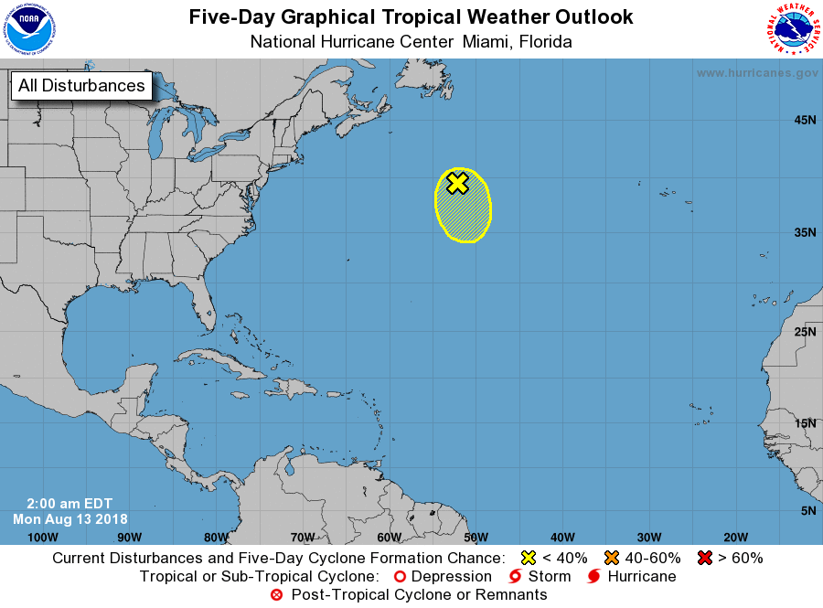
1. A small, non-tropical, low pressure system located about 500 miles
south of Cape Race, Newfoundland, is producing limited shower and
thunderstorm activity.  Strong upper-level winds are expected
to prevent significant development of this system during the next
few days while it moves south-southeastward at 10 to 15 mph over
the central sub-tropical Atlantic Ocean.
* Formation chance through 48 hours...low...10 percent.
* Formation chance through 5 days...low...20 percent.

Forecaster Brown


List of Atlantic Outlooks (May 2023 - present)
List of East Pacific Outlooks (May 2023 - present)
List of Central Pacific Outlooks (May 2023 - present)
List of Atlantic Outlooks (July 2014 - April 2023)
List of East Pacific Outlooks (July 2014 - April 2023)
List of Central Pacific Outlooks (June 2019 - April 2023)
List of Atlantic Outlooks (June 2009 - June 2014)
List of East Pacific Outlooks (June 2009 - June 2014)