ZCZC MIATWOAT ALL
TTAA00 KNHC DDHHMM
Tropical Weather Outlook
NWS National Hurricane Center Miami FL
200 PM EDT Fri Aug 10 2018
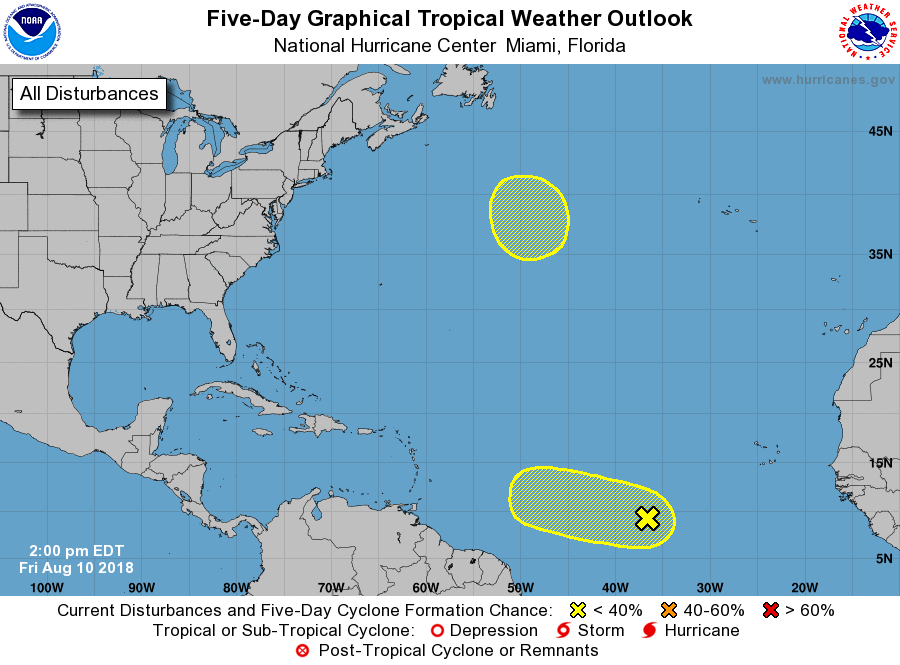
For the North Atlantic...Caribbean Sea and the Gulf of Mexico:
1. An area of disturbed weather is located about midway between Africa
and the Lesser Antilles. Strong upper-level winds are likely to
limit development of this system for the next day or two, but some
gradual development is possible after that time while the system
moves slowly westward through early next week.
* Formation chance through 48 hours...low...10 percent.
* Formation chance through 5 days...low...20 percent.
2. A non-tropical area of low pressure is forecast to form over the
central Atlantic in a few days. The low could gradually acquire
subtropical or tropical characteristics while moving slowly
northeastward for couple of days thereafter.
* Formation chance through 48 hours...low...near 0 percent.
* Formation chance through 5 days...low...20 percent.
Forecaster Zelinsky