ZCZC MIATWOAT ALL
TTAA00 KNHC DDHHMM
Tropical Weather Outlook
NWS National Hurricane Center Miami FL
200 AM EDT Tue Aug 7 2018
For the North Atlantic...Caribbean Sea and the Gulf of Mexico:
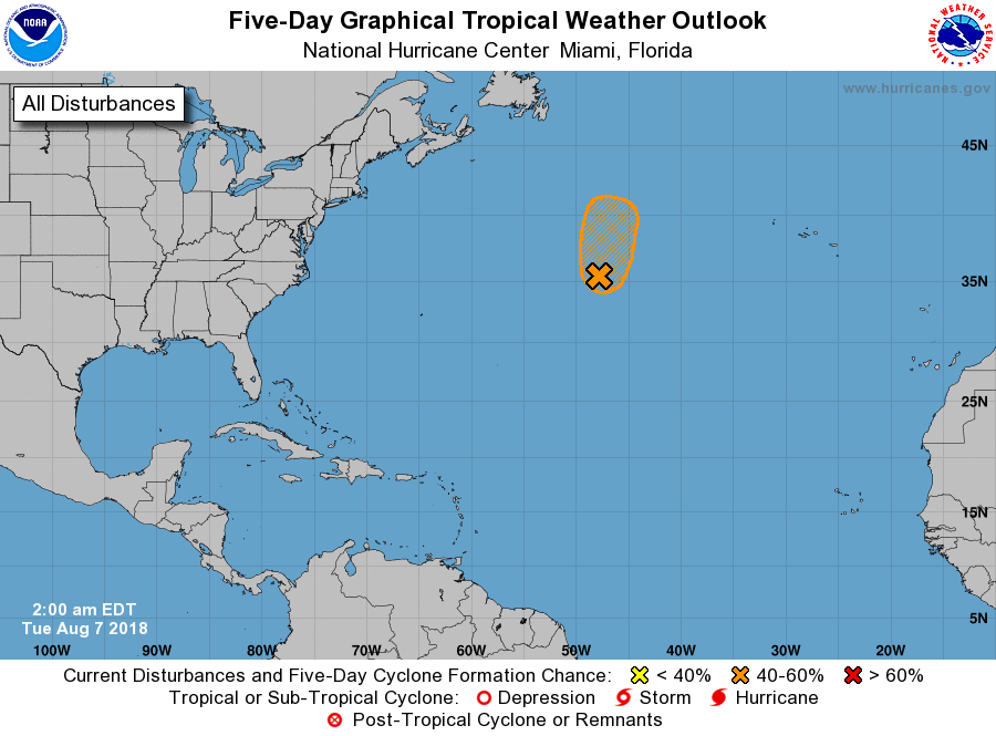
1. Satellite data indicate that thunderstorm activity during the past
several hours has increased and become better organized in
association with a well-defined, non-tropical low pressure system
centered about 950 miles west-southwest of the Azores. Environmental
conditions are expected to be somewhat conducive for the system to
acquire subtropical or tropical characteristics later today. By
Wednesday, however, the low will encounter increasingly cooler
waters, which will hinder development while the system moves toward
the north-northeast over the open North Atlantic. Additional
information on this system can be found in High Seas Forecasts
issued by the National Weather Service.
* Formation chance through 48 hours...medium...50 percent.
* Formation chance through 5 days...medium...50 percent.
High Seas Forecasts issued by the National Weather Service can be
found under AWIPS header NFDHSFAT1, WMO header FZNT01 KWBC, and
on the Web at https://ocean.weather.gov/shtml/NFDHSFAT1.shtml.
Forecaster Stewart