ZCZC MIATWOAT ALL
TTAA00 KNHC DDHHMM
Tropical Weather Outlook
NWS National Hurricane Center Miami FL
800 PM EDT Sun Aug 5 2018
For the North Atlantic...Caribbean Sea and the Gulf of Mexico:
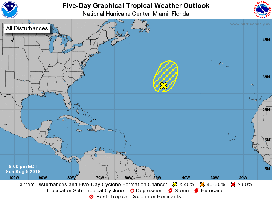
1. A non-tropical low pressure system centered about 1050 miles
west-southwest of the Azores continues to produce limited shower
activity. Environmental conditions are expected to be only
marginally conducive for the low to acquire subtropical or
tropical characteristics while it moves little over the next
day or so, and then moves north-northeastward through Tuesday.
Additional information on this system can be found in High Seas
Forecasts issued by the National Weather Service.
* Formation chance through 48 hours...low...20 percent.
* Formation chance through 5 days...low...20 percent.
High Seas Forecasts issued by the National Weather Service can be
found under AWIPS header NFDHSFAT1, WMO header FZNT01 KWBC, and
on the Web at https://ocean.weather.gov/shtml/NFDHSFAT1.shtml.
Forecaster Beven