ZCZC MIATWOAT ALL
TTAA00 KNHC DDHHMM CCA
Special Tropical Weather Outlook...Corrected
NWS National Hurricane Center Miami FL
1135 AM EDT Sat Jul 14 2018
For the North Atlantic...Caribbean Sea and the Gulf of Mexico:
Special Outlook to update the discussion on the remnants of Beryl
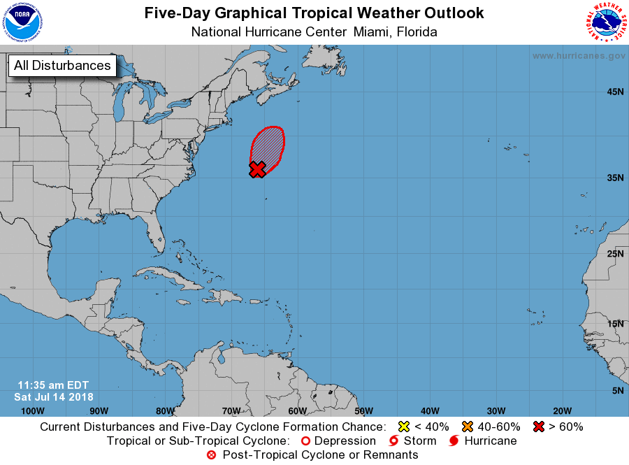
1. An area of low pressure, associated with the remnants of Beryl, is
now located about 270 miles north-northwest of Bermuda. Satellite
imagery indicates that the associated thunderstorm activity is
becoming better organized, and if current trends continue advisories
on a subtropical or tropical cyclone could be re-initiated later
today. Additional information on this system can be found in High
Seas Forecasts issued by the National Weather Service, under AWIPS
header NFDHSFAT1, WMO header FZNT01 KWBC, and available on the Web
at https://ocean.weather.gov/shtml/NFDHSFAT1.shtml.
* Formation chance through 48 hours...high...70 percent.
* Formation chance through 5 days...high...70 percent.
Forecaster Beven