ZCZC MIATWOAT ALL
TTAA00 KNHC DDHHMM
Tropical Weather Outlook
NWS National Hurricane Center Miami FL
200 AM EDT Fri Jul 13 2018
For the North Atlantic...Caribbean Sea and the Gulf of Mexico:
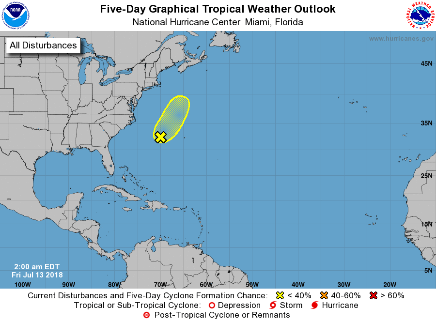
1. A weak area of low pressure, associated with the remnants of Beryl,
has formed about 300 miles west of Bermuda, but showers and
thunderstorms associated with this system remain disorganized due to
strong upper-level winds. These winds are expected to become even
less conducive for tropical or subtropical development over the
next day or two while the low moves north-northeastward at about 10
mph, and development will be limited once the low reaches colder
waters by Saturday night or Sunday.
* Formation chance through 48 hours...low...20 percent.
* Formation chance through 5 days...low...30 percent.
Forecaster Berg