ZCZC MIATWOAT ALL
TTAA00 KNHC DDHHMM
Tropical Weather Outlook
NWS National Hurricane Center Miami FL
200 PM EDT Thu Jul 12 2018
For the North Atlantic...Caribbean Sea and the Gulf of Mexico:
The National Hurricane Center has issued its last advisory on
Post-Tropical Cyclone Chris, located a little over 200 miles
west-southwest of Cape Race, Newfoundland.
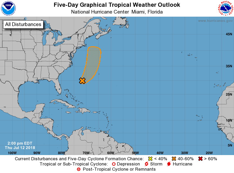
1. An elongated area of showers and thunderstorms associated with the
remnants of Beryl is located about 400 miles west-southwest of
Bermuda. Little or no development is expected through Friday while
the system moves northeastward. However, environmental conditions
could become a little more favorable over the weekend when the
disturbance will be moving northward or north-northeastward over the
warm waters of the western Atlantic and interacting with a strong
upper-level trough.
* Formation chance through 48 hours...low...10 percent.
* Formation chance through 5 days...medium...50 percent.
Forecaster Stewart