ZCZC MIATWOAT ALL
TTAA00 KNHC DDHHMM
Tropical Weather Outlook
NWS National Hurricane Center Miami FL
200 PM EDT Fri Jul 6 2018
For the North Atlantic...Caribbean Sea and the Gulf of Mexico:
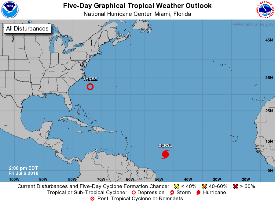
The National Hurricane Center is issuing advisories on Hurricane
Beryl, located over the central tropical Atlantic Ocean about a
thousand miles east-southeast of the Lesser Antilles.
1. Showers and thunderstorms associated with a well-defined but
still weak low pressure system located a few hundred miles
southeast of the North Carolina coast are gradually becoming better
organized, although surface pressures in the area remain high.
Environmental conditions are expected to be conducive for additional
development of this system, and a tropical depression is likely to
form over the next couple of days while it moves slowly
northwestward and stalls or meanders near the coast of North
Carolina over the weekend. Interests along the North Carolina and
South Carolina coasts should monitor the progress of this system
during the next several days.
* Formation chance through 48 hours...high...70 percent.
* Formation chance through 5 days...high...80 percent.
Forecaster Berg