ZCZC MIATWOAT ALL
TTAA00 KNHC DDHHMM
Tropical Weather Outlook
NWS National Hurricane Center Miami FL
800 PM EDT Thu Jul 5 2018
For the North Atlantic...Caribbean Sea and the Gulf of Mexico:
The National Hurricane Center is issuing advisories on Tropical
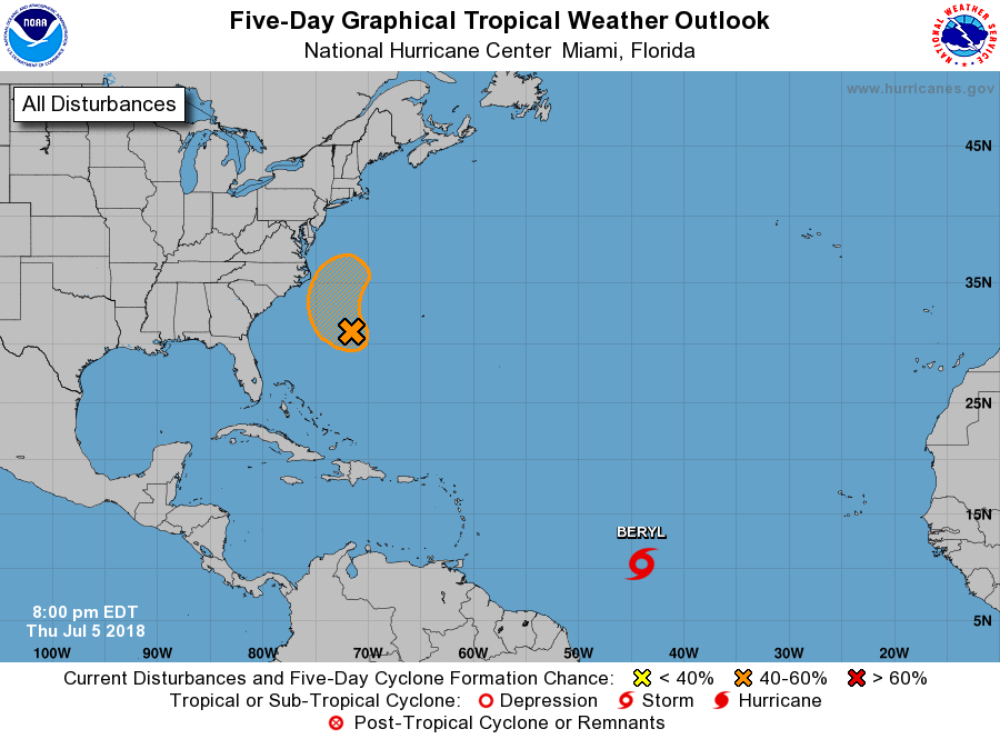
Storm Beryl, located over the central tropical Atlantic Ocean
more than a thousand miles east-southeast of the Lesser Antilles.
1. A well-defined low pressure system located about midway between
the southeastern United States and Bermuda continues to produce
disorganized showers and thunderstorms. However, environmental
conditions appear conducive for some development through the end
of the week while the system moves slowly west-northwestward and
then northward off the coast of North Carolina. The low could
interact with a frontal system on Sunday, which would limit any
additional development.
* Formation chance through 48 hours...medium...40 percent.
* Formation chance through 5 days...medium...50 percent.
Public Advisories on Tropical Storm Beryl are issued under WMO
header WTNT32 KNHC and under AWIPS header MIATCPAT2.
Forecast/Advisories on Tropical Storm Beryl are issued under WMO
header WTNT22 KNHC and under AWIPS header MIATCMAT2.
Forecaster Stewart