ZCZC MIATWOAT ALL
TTAA00 KNHC DDHHMM
Tropical Weather Outlook
NWS National Hurricane Center Miami FL
800 PM EDT Wed Jun 13 2018
For the North Atlantic...Caribbean Sea and the Gulf of Mexico:
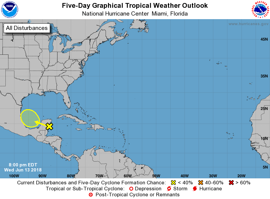
1. A surface trough over the northwestern Caribbean Sea and the Yucatan
Peninsula continues to produce disorganized showers and
thunderstorms. This area of disturbed weather, accompanied by strong
gusty winds, is expected to move west-northwestward across the
Yucatan Peninsula and over the southwestern Gulf of Mexico on
Thursday. Environmental conditions could become slightly more
conducive for some development of this disturbance when it moves
across the southwestern Gulf of Mexico on Friday and this weekend.
* Formation chance through 48 hours...low...near 0 percent.
* Formation chance through 5 days...low...20 percent.
Forecaster Cangialosi