ZCZC MIATWOAT ALL
TTAA00 KNHC DDHHMM
Tropical Weather Outlook
NWS National Hurricane Center Miami FL
200 PM EDT Mon Jun 11 2018
For the North Atlantic...Caribbean Sea and the Gulf of Mexico:
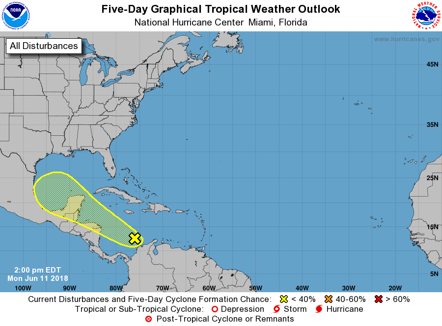
1. A broad area of showers and thunderstorms has persisted over the
southwestern Caribbean Sea for the past several hours. This activity
is associated with a tropical wave over northwestern Venezuela and
a surface trough located just east of Nicaragua interacting with a
large upper-level trough. Little development of this area of
disturbed weather is expected over the next few days due to
interaction with Central America and the Yucatan Peninsula. However,
environmental conditions could become somewhat more conducive for
some limited development when the system moves into the southwestern
Gulf of Mexico by the end of the week. Regardless of development,
this disturbance will produce locally heavy rainfall across portions
of Nicaragua, Honduras, Belize, Guatemala, and the Yucatan Peninsula
through Thursday.
* Formation chance through 48 hours...low...10 percent.
* Formation chance through 5 days...low...20 percent.
Forecaster Stewart