ZCZC MIATWOAT ALL
TTAA00 KNHC DDHHMM
Special Tropical Weather Outlook
NWS National Hurricane Center Miami FL
340 PM EDT Sun May 13 2018
For the North Atlantic...Caribbean Sea and the Gulf of Mexico:
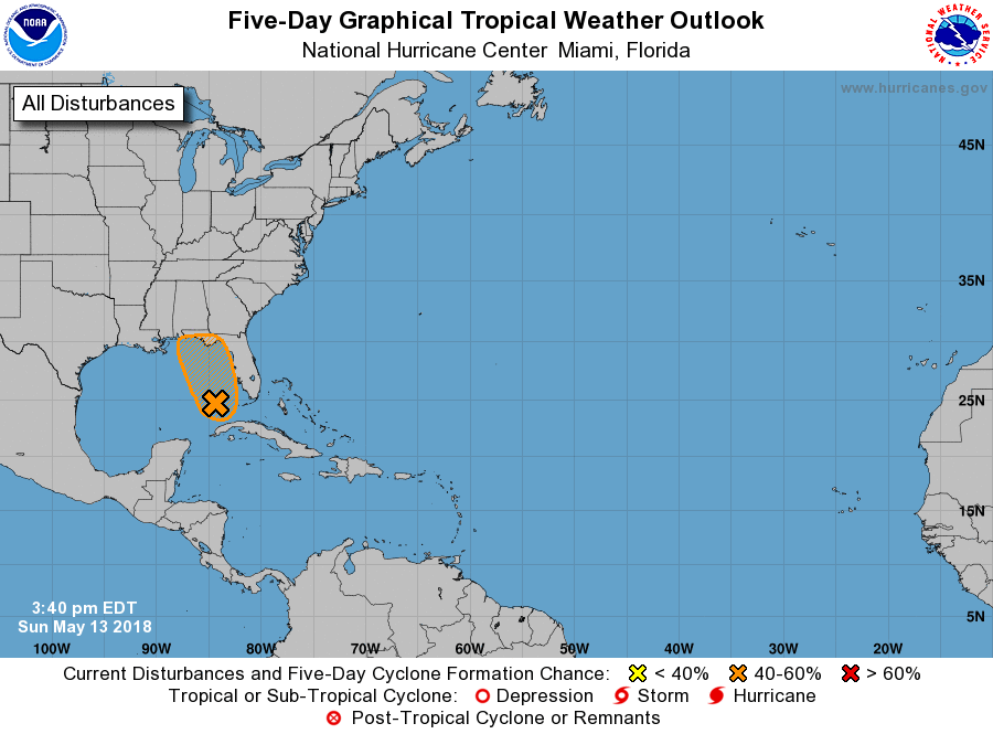
1. A large area of cloudiness, showers, and thunderstorms extending
from western Cuba across the southeastern Gulf of Mexico, the
Florida Straits, and much of the Florida Peninsula is associated
with a broad surface low and trough interacting with an upper-level
low. This system could acquire some subtropical or tropical
characteristics while it moves slowly northward across the eastern
Gulf of Mexico during the next few days. Regardless of subtropical
or tropical cyclone formation, this system will enhance rainfall
across portions of Florida and the northeastern Gulf Coast during
the next few days. For more information on this system, please see
products issued by your local weather office. The next Special
Tropical Weather Outlook on this system will be issued by 11 AM EDT
Monday.
* Formation chance through 48 hours...low...30 percent.
* Formation chance through 5 days...medium...40 percent.
Forecaster Brennan