Skip Navigation Links
NOAA NOAA United States Department of Commerce

NHC Graphical Outlook Archive


« Earliest Available         ‹ Earlier         Later ›         Latest Available »
GIS Shapefiles
tab Eastern North Pacific tab tab Atlantic tab

View 2-Day Graphical Tropical Weather Outlook
Click for Eastern North Pacific Click for Eastern North Pacific

Tropical Weather Outlook Text

ZCZC MIATWOAT ALL
TTAA00 KNHC DDHHMM

Tropical Weather Outlook
NWS National Hurricane Center Miami FL
100 AM EST Mon Nov 13 2017

For the North Atlantic...Caribbean Sea and the Gulf of Mexico:

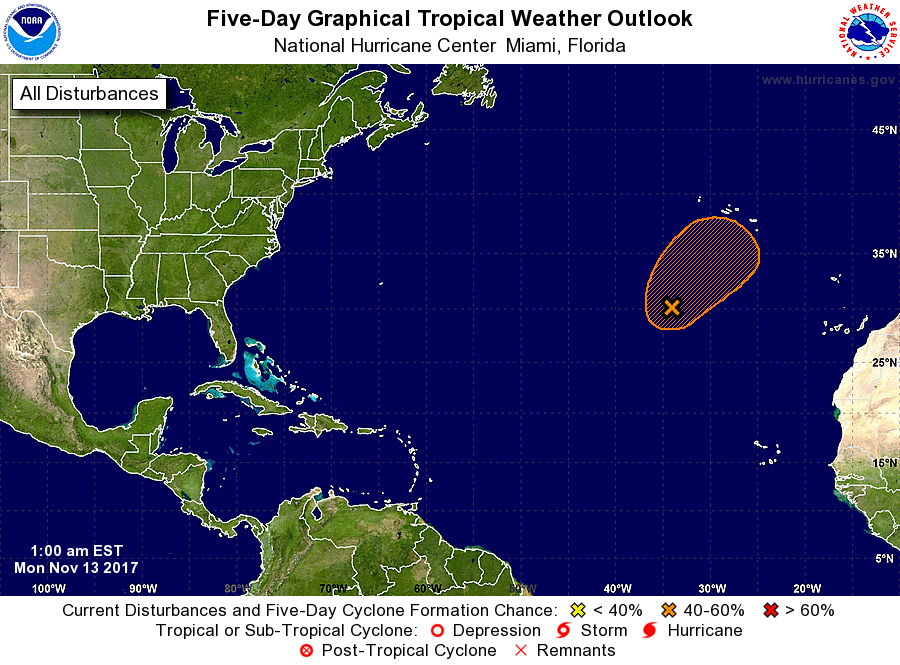
1. Showers and thunderstorms continue to show some signs of
organization in association with a low pressure system located about
700 miles southwest of the Azores.  Environmental conditions are
expected to be conducive for some additional development, and the
system could become a subtropical cyclone during the next few days
while it moves slowly northeastward.
* Formation chance through 48 hours...low...30 percent.
* Formation chance through 5 days...medium...50 percent.

Forecaster Stewart


List of Atlantic Outlooks (May 2023 - present)
List of East Pacific Outlooks (May 2023 - present)
List of Central Pacific Outlooks (May 2023 - present)
List of Atlantic Outlooks (July 2014 - April 2023)
List of East Pacific Outlooks (July 2014 - April 2023)
List of Central Pacific Outlooks (June 2019 - April 2023)
List of Atlantic Outlooks (June 2009 - June 2014)
List of East Pacific Outlooks (June 2009 - June 2014)