Skip Navigation Links
NOAA NOAA United States Department of Commerce

NHC Graphical Outlook Archive


« Earliest Available         ‹ Earlier         Later ›         Latest Available »
GIS Shapefiles
tab Eastern North Pacific tab tab Atlantic tab

View 2-Day Graphical Tropical Weather Outlook
Click for Eastern North Pacific Click for Eastern North Pacific

Tropical Weather Outlook Text

ZCZC MIATWOAT ALL
TTAA00 KNHC DDHHMM

Tropical Weather Outlook
NWS National Hurricane Center Miami FL
200 PM EDT Mon Oct 30 2017

For the North Atlantic...Caribbean Sea and the Gulf of Mexico:

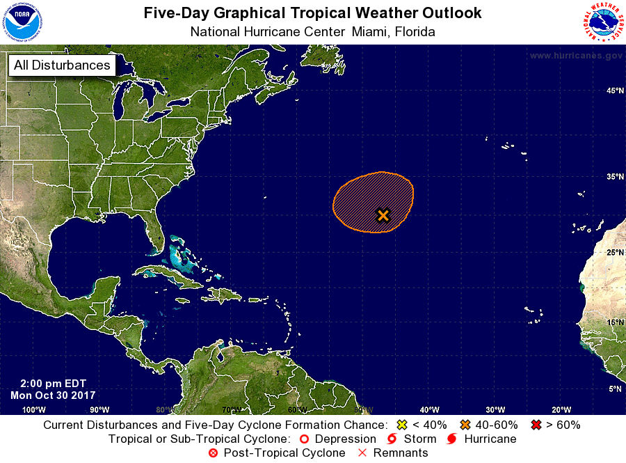
1. A well-defined, non-tropical low pressure system located about 1000
miles east of Bermuda is producing a large area of disorganized
showers and thunderstorms, mainly northeast through southeast of
the center.  This low could gradually acquire some subtropical or
tropical characteristics by the middle of the week while it meanders
over the central Atlantic Ocean between Bermuda and the Azores.
* Formation chance through 48 hours...low...30 percent.
* Formation chance through 5 days...medium...40 percent.

Forecaster Stewart


List of Atlantic Outlooks (May 2023 - present)
List of East Pacific Outlooks (May 2023 - present)
List of Central Pacific Outlooks (May 2023 - present)
List of Atlantic Outlooks (July 2014 - April 2023)
List of East Pacific Outlooks (July 2014 - April 2023)
List of Central Pacific Outlooks (June 2019 - April 2023)
List of Atlantic Outlooks (June 2009 - June 2014)
List of East Pacific Outlooks (June 2009 - June 2014)