ZCZC MIATWOAT ALL
TTAA00 KNHC DDHHMM
Tropical Weather Outlook
NWS National Hurricane Center Miami FL
200 AM EDT Fri Oct 27 2017
For the North Atlantic...Caribbean Sea and the Gulf of Mexico:
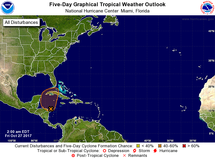
1. Shower activity associated with a trough of low preesure over the
northwestern Caribbean Sea has become more concentrated during the
past several hours between northeastern Honduras and Jamaica.
Environmental conditions are expected to be conducive for some
development today and Saturday as the system moves slowly northward
over the northwestern Caribbean Sea. Strong upper-level winds
associated with an approaching cold front will make conditions less
favorable by Sunday. Regardless of development, this system is
expected to produce locally heavy rainfall over the Cayman Islands,
Jamaica, and portions of Cuba during the next day or two. These
rains are forecast to spread northward across portions of South
Florida and the Keys on Saturday, and over the northwestern Bahamas
Saturday night and Sunday.
* Formation chance through 48 hours...medium...50 percent.
* Formation chance through 5 days...medium...50 percent.
Forecaster Beven