ZCZC MIATWOAT ALL
TTAA00 KNHC DDHHMM
Tropical Weather Outlook
NWS National Hurricane Center Miami FL
200 AM EDT Wed Oct 25 2017
For the North Atlantic...Caribbean Sea and the Gulf of Mexico:
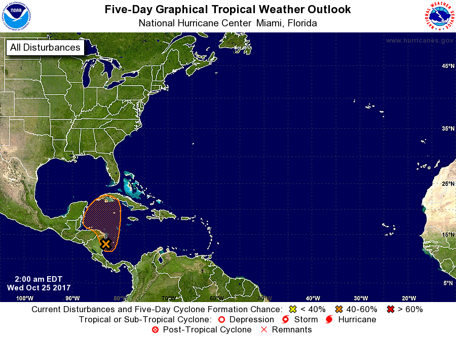
1. A broad area of low pressure over Nicaragua, Honduras, and the
adjacent Caribbean waters is producing widespread, but disorganized,
showers and thunderstorms. Close proximity to land is likely to
limit development of this system for the next day or so. However,
environmental conditions are expected to be conducive for some
development to occur later this week while the system moves slowly
northward over the northwestern Caribbean Sea. Regardless of
development, locally heavy rains are likely over portions of
Central America during the next several days.
* Formation chance through 48 hours...low...10 percent.
* Formation chance through 5 days...medium...50 percent.
Forecaster Beven