ZCZC MIATWOAT ALL
TTAA00 KNHC DDHHMM
Tropical Weather Outlook
NWS National Hurricane Center Miami FL
800 AM EDT Mon Oct 16 2017
For the North Atlantic...Caribbean Sea and the Gulf of Mexico:
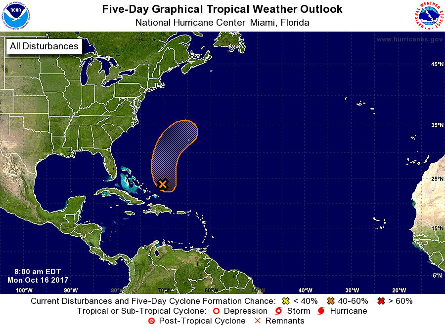
1. Showers and thunderstorms associated with a broad area of low
pressure located about 175 miles north-northeast of the Turks and
Caicos Islands have increased overnight. Although the system is
producing wind gusts to near tropical-storm force, satellite
imagery suggests that it lacks a well-defined center. Upper-level
winds are forecast to remain marginally conducive for some
additional development during the next day or so while the system
moves generally northward. Conditions are expected to become
unfavorable for further development by Wednesday when the
disturbance merges with a frontal system over the western Atlantic.
* Formation chance through 48 hours...medium...40 percent.
* Formation chance through 5 days...medium...40 percent.
Forecaster Brown