ZCZC MIATWOAT ALL
TTAA00 KNHC DDHHMM
Tropical Weather Outlook
NWS National Hurricane Center Miami FL
200 PM EDT Sun Oct 15 2017
For the North Atlantic...Caribbean Sea and the Gulf of Mexico:
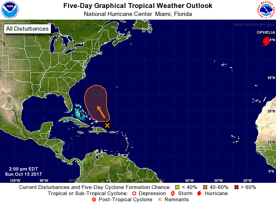
The National Hurricane Center is issuing advisories on Hurricane
Ophelia, located over the far eastern Atlantic Ocean more than 600
miles east-northeast of the Azores.
1. A broad area of low pressure is moving toward the west-northwest and
is now located about 150 miles north of Hispaniola. The low is
producing numerous showers and a few squalls mainly to the east of
the center. Since upper-level winds are not particularly favorable
for tropical cyclone formation, further development of this system,
if any, will be slow to occur. The low and its associated activity
is forecast to move toward the northwest and north during the next
two to three days. After that time, this system is expected to merge
with a cold front.
* Formation chance through 48 hours...low...30 percent.
* Formation chance through 5 days...medium...50 percent.
Forecaster Avila