Skip Navigation Links
NOAA NOAA United States Department of Commerce

NHC Graphical Outlook Archive


« Earliest Available         ‹ Earlier         Later ›         Latest Available »
GIS Shapefiles
tab Eastern North Pacific tab tab Atlantic tab

View 2-Day Graphical Tropical Weather Outlook
Click for Eastern North Pacific Click for Eastern North Pacific

Tropical Weather Outlook Text

ZCZC MIATWOAT ALL
TTAA00 KNHC DDHHMM

Tropical Weather Outlook
NWS National Hurricane Center Miami FL
200 AM EDT Fri Oct 6 2017

For the North Atlantic...Caribbean Sea and the Gulf of Mexico:

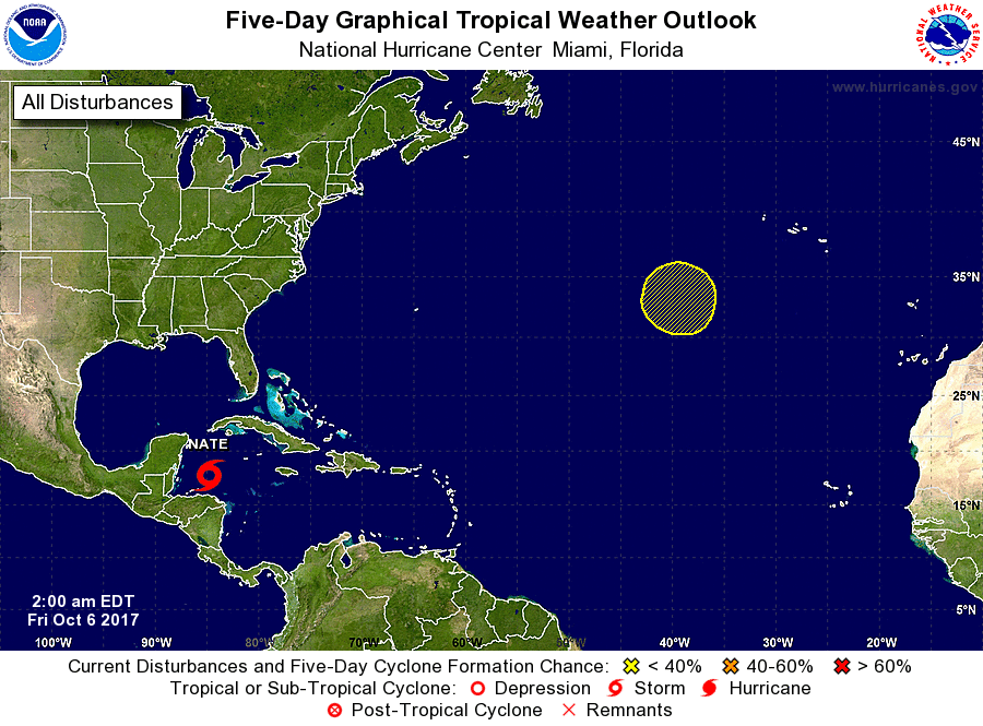
The National Hurricane Center is issuing advisories on Tropical
Storm Nate, located over the Gulf of Honduras.

1. An area of low pressure is forecast to form in the next day or two
along the southern extent of a frontal boundary, about 900 miles
southwest of the Azores. This low could subsequently acquire some
subtropical or tropical characteristics while it remains nearly
stationary over the northeastern Atlantic Ocean during the next
few
days.
* Formation chance through 48 hours...low...10 percent.
* Formation chance through 5 days...low...30 percent.

Forecaster Landsea


List of Atlantic Outlooks (May 2023 - present)
List of East Pacific Outlooks (May 2023 - present)
List of Central Pacific Outlooks (May 2023 - present)
List of Atlantic Outlooks (July 2014 - April 2023)
List of East Pacific Outlooks (July 2014 - April 2023)
List of Central Pacific Outlooks (June 2019 - April 2023)
List of Atlantic Outlooks (June 2009 - June 2014)
List of East Pacific Outlooks (June 2009 - June 2014)