ZCZC MIATWOAT ALL
TTAA00 KNHC DDHHMM
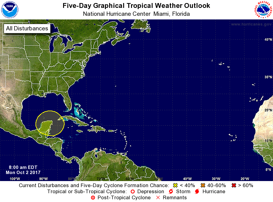
Tropical Weather Outlook
NWS National Hurricane Center Miami FL
800 AM EDT Mon Oct 2 2017
For the North Atlantic...Caribbean Sea and the Gulf of Mexico:
1. Disorganized showers and thunderstorms across portions of the
Yucatan Peninsula, Central America, and the northwestern Caribbean
Sea are associated with surface trough that is interacting with an
upper-level low. Some slow development of this system is possible
by the end of the week or this weekend while it drifts northward
into the southern Gulf of Mexico.
* Formation chance through 48 hours...low...near 0 percent.
* Formation chance through 5 days...low...20 percent.
Forecaster Cangialosi