ZCZC MIATWOAT ALL
TTAA00 KNHC DDHHMM
Tropical Weather Outlook
NWS National Hurricane Center Miami FL
800 PM EDT Sat Sep 30 2017
For the North Atlantic...Caribbean Sea and the Gulf of Mexico:
The National Hurricane Center has issued its last advisory on
Post-Tropical Cyclone Maria, located several hundred miles
east-southeast of Cape Race, Newfoundland.
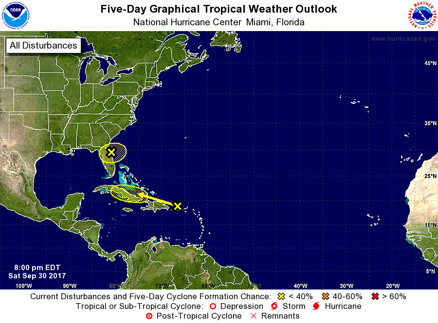
1. Surface observations and coastal radar data indicate that an area
of low pressure has developed near the northeastern coast of the
Florida Peninsula between Daytona Beach and St. Augustine, and that
winds to near gale-force are occurring to the north of the center.
Additional development into a tropical cyclone appears unlikely due
to unfavorable upper-level winds. However, gusty winds and locally
heavy rains are likely over portions of northeastern Florida and
southeastern Georgia tonight and Sunday. Please see statements
from local National Weather Service forecast offices for additional
information.
* Formation chance through 48 hours...low...20 percent.
* Formation chance through 5 days...low...20 percent.
2. A tropical wave interacting with an upper-level low is producing
a large but disorganized area of cloudiness and showers extending
from the eastern Caribbean Sea northward across the Leeward
Islands, Virgin islands, and Puerto Rico to the nearby Atlantic
waters. Environmental conditions are not favorable for development
and tropical cyclone formation is not forecast. This system is
expected to move west-northwestward to westward at 10 to 15 mph
during the next few days bringing locally heavy rainfall over
portions of the northern Leeward Islands, the Virgin Islands and the
Greater Antilles during the next several days. A Flash Flood Watch
in effect for Puerto Rico and the U.S. Virgin Islands through late
Sunday night.
* Formation chance through 48 hours...low...near 0 percent.
* Formation chance through 5 days...low...near 0 percent.
Forecaster Beven