ZCZC MIATWOAT ALL
TTAA00 KNHC DDHHMM
Tropical Weather Outlook
NWS National Hurricane Center Miami FL
200 PM EDT Sat Sep 30 2017
For the North Atlantic...Caribbean Sea and the Gulf of Mexico:
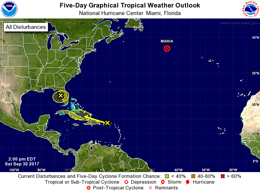
The National Hurricane Center is issuing advisories on Tropical
Storm Maria, located several hundred miles south-southeast of Cape
Race, Newfoundland.
1. A trough of low pressure extends from the Yucatan peninsula
northeastward across the eastern Gulf of Mexico to a weak low over
north Florida. This system, in combination with an upper-level low
over the Gulf of Mexico, is triggering widespread cloudiness and
showers over the northwestern Caribbean and the eastern Gulf of
Mexico. Environmental conditions are not conducive for development
and tropical cyclone formation is not anticipated. Nevertheless,
locally heavy rainfall will likely continue over portions of western
Cuba, the Florida Keys, and the Florida peninsula during the next
several days while the system moves generally westward.
* Formation chance through 48 hours...low...10 percent.
* Formation chance through 5 days...low...10 percent.
2. A tropical wave interacting with an upper-level low is producing
a large but disorganized area of cloudiness and showers extending
from the eastern Caribbean Sea northward across the Lesser Antilles
to the nearby Atlantic waters. Environmental conditions are not
favorable for development and tropical cyclone formation is not
forecast. This system is expected to move west-northwestward to
westward at 10 to 15 mph during the next few days bringing locally
heavy rainfall over portions of the northern Leeward Islands and the
Greater Antilles during the next several days. A Flash Flood Watch
in effect for Puerto Rico and the U.S. Virgin Islands through late
Sunday night.
* Formation chance through 48 hours...low...near 0 percent.
* Formation chance through 5 days...low...near 0 percent.
Forecaster Avila