ZCZC MIATWOAT ALL
TTAA00 KNHC DDHHMM
Tropical Weather Outlook
NWS National Hurricane Center Miami FL
200 AM EDT Thu Sep 28 2017
For the North Atlantic...Caribbean Sea and the Gulf of Mexico:
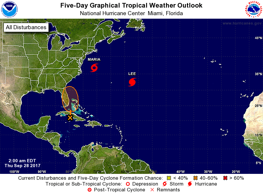
The National Hurricane Center is issuing advisories on Hurricane
Maria, located a few hundred miles east-northeast of Cape Hatteras,
North Carolina, and on Hurricane Lee, located over the central
Atlantic Ocean.
1. A large area of cloudiness and showers extending from the
northwestern Caribbean Sea across Cuba to the Bahamas is associated
with a surface trough interacting with an upper-level low. An area
of low pressure is likely to form from this weather system while it
moves northward across Cuba and near the east coast of the Florida
peninsula during the next few days, and environmental conditions
appear conducive for development before upper-level winds become
less favorable early next week. Regardless of development, this
system is likely to produce locally heavy rainfall over portions of
Cuba, southern Florida, the Florida Keys, and the Bahamas during the
next several days.
* Formation chance through 48 hours...low...20 percent.
* Formation chance through 5 days...medium...40 percent.
Forecaster Berg