ZCZC MIATWOAT ALL
TTAA00 KNHC DDHHMM
Tropical Weather Outlook
NWS National Hurricane Center Miami FL
800 PM EDT Tue Sep 19 2017
For the North Atlantic...Caribbean Sea and the Gulf of Mexico:
The National Hurricane Center is issuing advisories on Hurricane
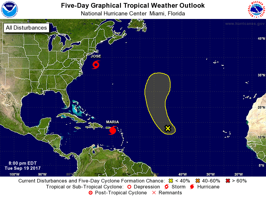
Jose, located a couple of hundred miles south-southwest of
Nantucket, Massachusetts, and on extremely dangerous Hurricane
Maria, located over the northeastern Caribbean Sea approaching the
U.S. Virgin Islands and Puerto Rico.
1. A small area of low pressure associated with remnants of Lee is
producing disorganized shower activity about midway between the Cabo
Verde Islands and the Leeward Islands. No development is expected
during the next day or so, but environmental conditions could
turn marginally conducive for tropical cyclone regeneration by the
weekend. This low is expected to move northward over the central
Atlantic Ocean.
* Formation chance through 48 hours...low...10 percent.
* Formation chance through 5 days...low...20 percent.
Forecaster Avila