ZCZC MIATWOAT ALL
TTAA00 KNHC DDHHMM
Tropical Weather Outlook
NWS National Hurricane Center Miami FL
800 PM EDT Fri Sep 15 2017
For the North Atlantic...Caribbean Sea and the Gulf of Mexico:
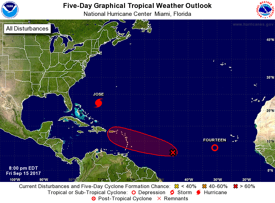
The National Hurricane Center is issuing advisories on Hurricane
Jose, located several hundred miles southwest of Bermuda, and on
Tropical Depression Fourteen, located over the eastern Atlantic
Ocean.
1. Showers and thunderstorms associated with a tropical wave located
a little more than 1000 miles east of the Windward Islands are
showing signs of organization. Environmental conditions are
conducive for additional development, and a tropical cyclone is
likely to form during the next day or so while the system moves
westward or west-northwestward around 20 mph. Interests in the
Lesser Antilles and northeastern Caribbean should closely monitor
the progress of this system. Tropical storm or hurricane watches
could be issued for portions of the Lesser Antilles on Saturday.
* Formation chance through 48 hours...high...80 percent.
* Formation chance through 5 days...high...90 percent.
Forecaster Brown