ZCZC MIATWOAT ALL
TTAA00 KNHC DDHHMM
Tropical Weather Outlook
NWS National Hurricane Center Miami FL
200 AM EDT Mon Sep 11 2017
For the North Atlantic...Caribbean Sea and the Gulf of Mexico:
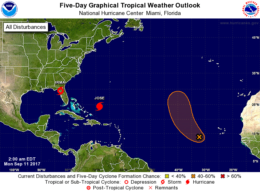
The National Hurricane Center is issuing advisories on Hurricane
Irma, located inland over west-central Florida. The Weather
Prediction Center is issuing advisories on Hurricane Jose,
located a few hundred miles north of the Dominican Republic.
1. A tropical wave located several hundred miles west-southwest of the
Cabo Verde Islands continues to produce disorganized showers and
thunderstorms. Some development of this system is possible during
the next couple of days before upper-level winds become unfavorable
for tropical cyclone formation. This system is expected to move
west-northwestward for the next two days and then turn northward
over the central Atlantic.
* Formation chance through 48 hours...low...30 percent.
* Formation chance through 5 days...medium...40 percent.
Forecaster Cangialosi/Ramos