ZCZC MIATWOAT ALL
TTAA00 KNHC DDHHMM
Tropical Weather Outlook
NWS National Hurricane Center Miami FL
800 AM EDT Sun Sep 10 2017
For the North Atlantic...Caribbean Sea and the Gulf of Mexico:
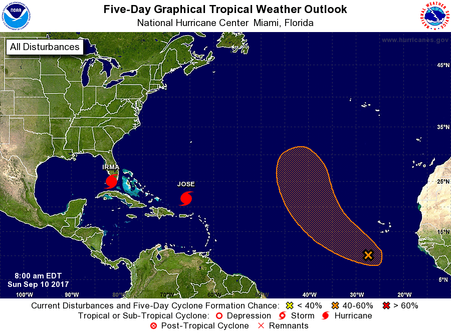
The National Hurricane Center is issuing advisories on Hurricane
Irma, located near the Florida Keys. The Weather Prediction Center
is issuing advisories on Hurricane Jose, located a couple hundred
miles north-northwest of the northern Leeward Islands.
1. Showers and thunderstorms associated with a tropical wave
located a few hundred miles south-southwest of the Cabo Verde
Islands continue to show some signs of organization. Environmental
conditions are expected to be conducive for some development, and a
tropical depression could form during the next few days while the
system moves generally northwestward over the eastern Atlantic
Ocean.
* Formation chance through 48 hours...low...30 percent.
* Formation chance through 5 days...medium...60 percent.
Forecaster Landsea