ZCZC MIATWOAT ALL
TTAA00 KNHC DDHHMM
Tropical Weather Outlook...Corrected
NWS National Hurricane Center Miami FL
800 AM EDT Sat Sep 9 2017
Corrected to reflect that Katia is a Tropical Depression.
For the North Atlantic...Caribbean Sea and the Gulf of Mexico:
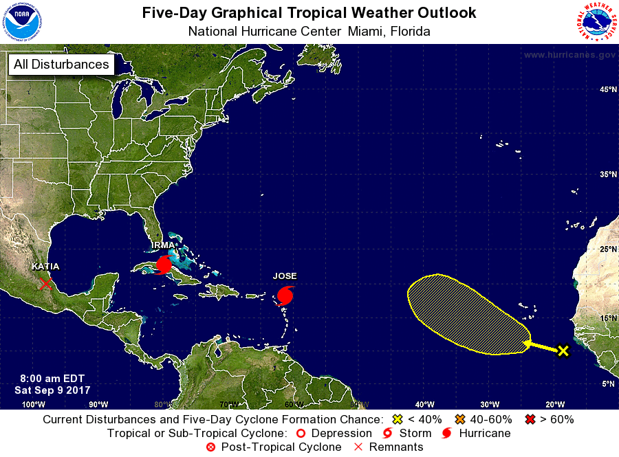
The National Hurricane Center is issuing advisories on Hurricane
Irma, located near the coast of central Cuba, on Hurricane Jose,
located a couple of hundred miles east of the Leeward Islands, and
on Tropical Depression Katia, located inland over eastern Mexico.
1. A tropical wave located several hundred miles southeast of the Cabo
Verde Islands is producing disorganized showers and thunderstorms.
This activity has increased since yesterday, and some gradual
development of this system is possible during the next few days
while it moves west-northwestward over the eastern Atlantic Ocean.
* Formation chance through 48 hours...low...10 percent.
* Formation chance through 5 days...low...30 percent.
Forecaster Zelinsky