ZCZC MIATWOAT ALL
TTAA00 KNHC DDHHMM
Tropical Weather Outlook
NWS National Hurricane Center Miami FL
200 AM EDT Mon Sep 4 2017
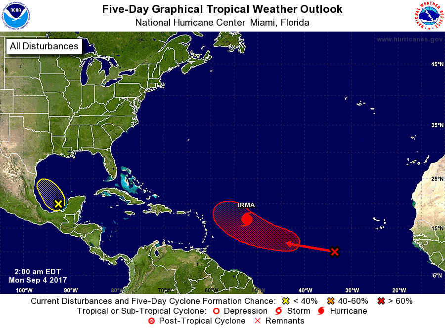
For the North Atlantic...Caribbean Sea and the Gulf of Mexico:
The National Hurricane Center is issuing advisories on Hurricane
Irma, located several hundred miles east of the Leeward Islands.
1. A tropical wave located several hundred miles southwest of the Cabo
Verde Islands continues to produce disorganized showers and
thunderstorms. Environmental conditions are expected to be
conducive for gradual development, and a tropical depression will
likely form later this week while the system moves west-
northwestward at 10 to 15 mph over the tropical Atlantic Ocean.
* Formation chance through 48 hours...low...10 percent.
* Formation chance through 5 days...high...70 percent.
2. A trough of low pressure located over the southwestern Gulf of
Mexico is producing disorganized showers and thunderstorms. Some
slow development of this system is possible during the next few
days while it drifts northwestward.
* Formation chance through 48 hours...low...10 percent.
* Formation chance through 5 days...low...30 percent.
Forecaster Cangialosi