ZCZC MIATWOAT ALL
TTAA00 KNHC DDHHMM
Tropical Weather Outlook
NWS National Hurricane Center Miami FL
200 PM EDT Tue Aug 29 2017
For the North Atlantic...Caribbean Sea and the Gulf of Mexico:
The National Hurricane Center is issuing advisories on Tropical
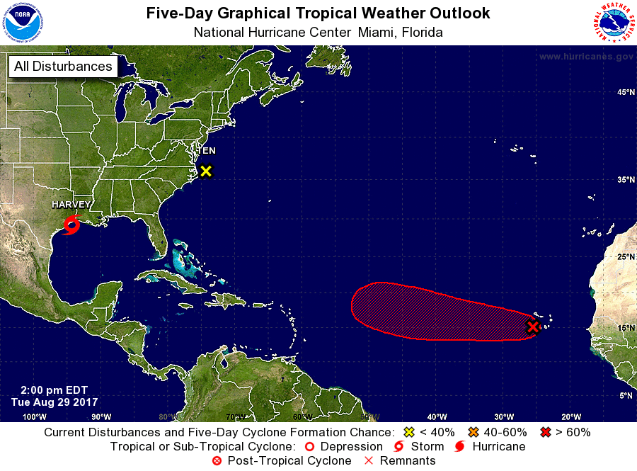
Storm Harvey, located just offshore of the middle Texas coast.
The National Hurricane Center is issuing advisories on Potential
Tropical Cyclone Ten, located near the Outer Banks of North
Carolina.
* Formation chance through 48 hours...low...10 percent.
* Formation chance through 5 days...low...10 percent.
1. A low pressure area located just west of the Cabo Verde Islands has
become better defined since yesterday. Any significant increase in
the associated thunderstorm activity would result in the formation
of a tropical depression within the next day or two. The low is
forecast to move generally west-northwestward at 15 to 20 mph over
the tropical Atlantic during the next several days. Heavy rain is
possible over portions of the northwestern Cabo Verde Islands
through tonight.
* Formation chance through 48 hours...high...80 percent.
* Formation chance through 5 days...high...90 percent.
Forecaster Blake