ZCZC MIATWOAT ALL
TTAA00 KNHC DDHHMM
Tropical Weather Outlook
NWS National Hurricane Center Miami FL
800 PM EDT Mon Aug 14 2017
For the North Atlantic...Caribbean Sea and the Gulf of Mexico:
The National Hurricane Center is issuing advisories on Tropical
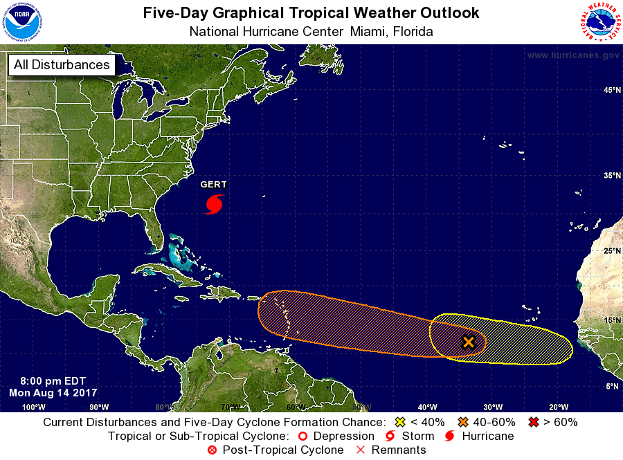
Storm Gert, located several hundred miles west-southwest of Bermuda.
1. An elongated area of low pressure located several hundred miles
west-southwest of the Cabo Verde Islands is producing a large area
of cloudiness and showers. Environmental conditions are expected
to be generally conducive for development during the next several
days while the disturbance moves westward at about 15 mph over the
tropical Atlantic.
* Formation chance through 48 hours...low...30 percent.
* Formation chance through 5 days...medium...60 percent.
2. A tropical wave over western Africa is forecast to emerge into the
far eastern Atlantic Ocean in about two days. Conditions appear
conducive for some development after that time while the wave moves
westward at about 15 mph.
* Formation chance through 48 hours...low...near 0 percent.
* Formation chance through 5 days...low...20 percent.
Forecaster Blake