ZCZC MIATWOAT ALL
TTAA00 KNHC DDHHMM
Tropical Weather Outlook
NWS National Hurricane Center Miami FL
200 AM EDT Sun Aug 13 2017
For the North Atlantic...Caribbean Sea and the Gulf of Mexico:
The National Hurricane Center is issuing advisories on newly formed
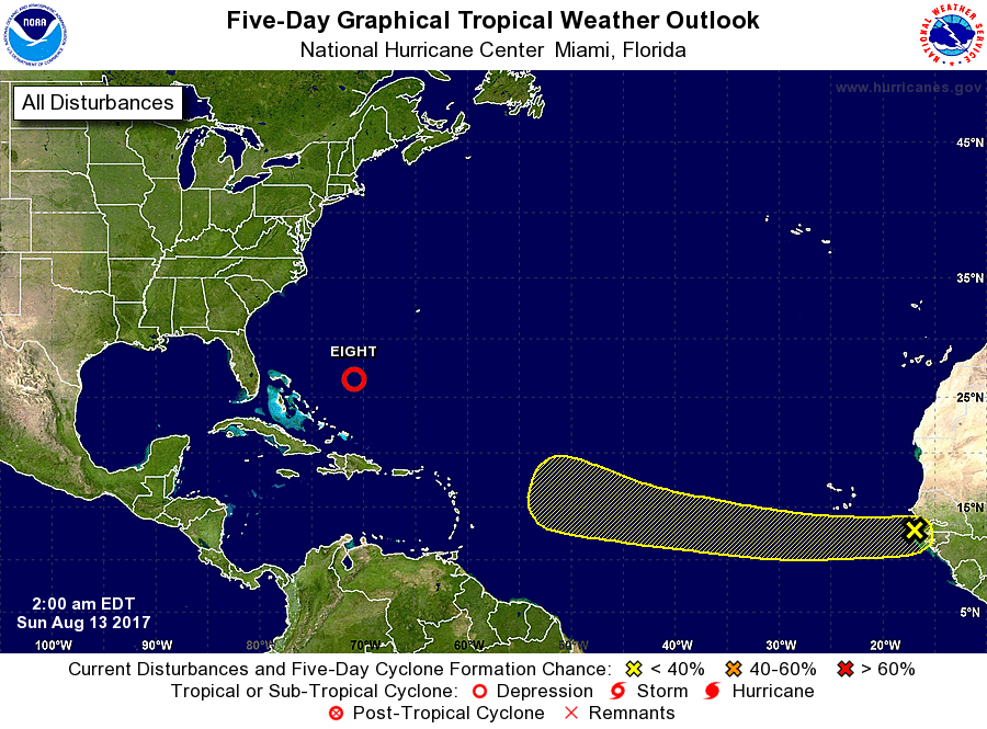
Tropical Depression Eight, located about 260 miles east of the
southeastern Bahamas.
1. A tropical wave that has just emerged off the west coast of Africa
is forecast to move westward over the next couple of days and merge
with a broad area of low pressure located southwest of the Cabo
Verde Islands. Thereafter, environmental conditions are expected to
be conducive for gradual development of the system while it moves
westward to west-northwestward at 10 to 15 mph over the open
tropical Atlantic Ocean.
* Formation chance through 48 hours...low...near 0 percent.
* Formation chance through 5 days...low...20 percent.
Public Advisories on Tropical Depression Eight are issued under WMO
header WTNT33 KNHC and under AWIPS header MIATCPAT3.
Forecast/Advisories on Tropical Depression Eight are issued under
WMO header WTNT23 KNHC and under AWIPS header MIATCMAT3.
Forecaster Stewart