ZCZC MIATWOAT ALL
TTAA00 KNHC DDHHMM
Tropical Weather Outlook
NWS National Hurricane Center Miami FL
800 PM EDT Sat Aug 12 2017
For the North Atlantic...Caribbean Sea and the Gulf of Mexico:
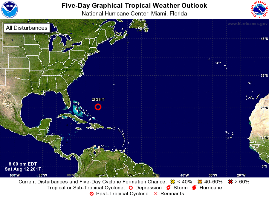
1. Showers and thunderstorms associated with a broad low pressure area
located about 250 miles northeast of the Turks and Caicos Islands
have become better organized during the past several hours, and
visible satellite images suggest a low-level circulation may be
forming. Environmental conditions are expected to remain conducive
for additional development, and a tropical depression is likely to
form tonight or Sunday while the system moves northwestward. The
low is forecast to turn northward, then northeastward away from the
United States early next week.
* Formation chance through 48 hours...high...80 percent.
* Formation chance through 5 days...high...80 percent.
Forecaster Brown