ZCZC MIATWOAT ALL
TTAA00 KNHC DDHHMM
Tropical Weather Outlook
NWS National Hurricane Center Miami FL
200 AM EDT Thu Aug 10 2017
For the North Atlantic...Caribbean Sea and the Gulf of Mexico:
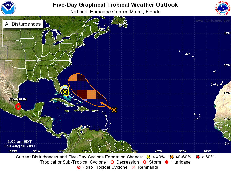
The National Hurricane Center is issuing advisories on Hurricane
Franklin, which has just made landfall in eastern Mexico.
1. Showers and thunderstorms associated with a trough of low pressure
located about 250 miles northeast of the northern Leeward Islands
remain limited in extent and organization. Some slow development of
this system is possible by this weekend while the trough moves
northwestward over the western Atlantic.
* Formation chance through 48 hours...low...20 percent.
* Formation chance through 5 days...medium...40 percent.
2. A trough of low pressure over the Bahamas and the Florida Straits
is producing disorganized shower activity. Although development
appears unlikely, this system could bring areas of heavy rain to
portions of the Bahamas and Florida during the next day or two.
* Formation chance through 48 hours...low...10 percent.
* Formation chance through 5 days...low...10 percent.
Forecaster Landsea