ZCZC MIATWOAT ALL
TTAA00 KNHC DDHHMM
Tropical Weather Outlook
NWS National Hurricane Center Miami FL
800 PM EDT Wed Aug 9 2017
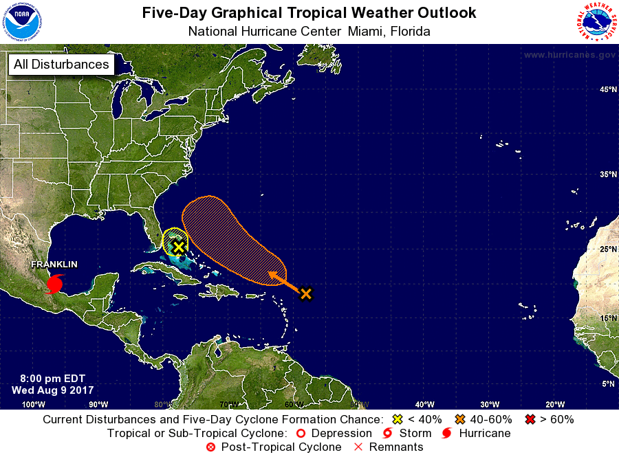
For the North Atlantic...Caribbean Sea and the Gulf of Mexico:
The National Hurricane Center is issuing advisories on recently
upgraded Hurricane Franklin, located over the Bay of Campeche.
1. Showers and thunderstorms associated with a trough of low pressure
located about 250 miles east-northeast of the northern Leeward
Islands have become a little better organized during the afternoon.
The environment is forecast to become more conducive for development
by this weekend while the trough moves northwestward over the
western Atlantic.
* Formation chance through 48 hours...low...20 percent.
* Formation chance through 5 days...medium...50 percent.
2. A trough of low pressure over the Bahamas continues to produce
disorganized shower activity. Although development appears
unlikely, this system could bring areas of heavy rain to portions of
the Bahamas and Florida during the next day or two.
* Formation chance through 48 hours...low...10 percent.
* Formation chance through 5 days...low...10 percent.
Forecaster Zelinsky